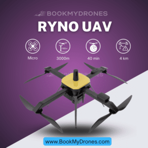
“VEDANSH” UAV, our revolutionary Micro category class Quadcopter Drone designed exclusively for Surveying & Mapping purposes! 💫📷🚁
Featuring dual battery pack technology, Vedansh ensures a longer flight endurance, allowing for seamless operations. Crafted with a lightweight and durable carbon composite body, weight is taken into consideration to optimize performance. With its highly reliable integrated system, Vedansh delivers exceptional results every time. ✅✨
When it comes to coverage, Vedansh has you covered! With a remarkable 0.6 sq km area coverage at 60 meters above ground level (AGL), this drone offers unparalleled efficiency. 🌍🌿
Compliant with NPNT regulations, Vedansh adheres to the highest standards, ensuring safe and legal operation. It boasts a remarkable flight time of up to 40 minutes, allowing for extensive data collection with minimal downtime. 📅⏱️
Equipped with L1 and L2 Freq capabilities, Vedansh ensures accurate and high-quality surveying and mapping results. Its payload includes a 24 Mp Electro-Optic Camera, delivering stunning visual data. 📸✨
To further enhance accuracy, Vedansh is PPK equipped, enabling precise positioning, even in challenging conditions. Its multi-band RTK GNSS receiver with centimeter precision Base Station achieves a fixed solution within seconds, providing reliable performance over distances up to 60 km in RTK and 100 km in PPK mode. 🛰️🎯
The combination of mapping payload with the PPK module makes Vedansh a powerhouse in its class. Featuring an APS-C CMOS Sony Sensor, it delivers unprecedented accuracy and generates high-resolution pan-sharpened output resolutions of 2 cm at 60 m. Its five narrow multispectral bands with scientific-grade filters enable the calculation of various vegetation indices and composites, offering invaluable insights. 🌱📊🖼️
With a storage capacity expandable up to 128GB, Vedansh ensures ample space for data collection and storage. Its ultralight carbon composite body, tuned software and hardware, strong build quality, low weight, and easy portability empower its usability in a variety of applications. 🎒💻🌐
When it comes to applications, Vedansh truly shines! With its RGB sensor, it is perfect for tasks such as plant counting, phenotyping, plant health mapping, fertilizer management, species differentiation and weed detection, advanced crop scouting, high-resolution 3D point clouds, and disease identification. 🌱🌿👨🌾📐🏭🌊🌎
The highly accurate outputs derived from Vedansh’s drone surveying capabilities revolutionize industries such as roadway and railway expansion (corridor mapping), mining, oil and gas, manufacturing, industrial, disaster management, and many more. By utilizing Vedansh, businesses can reach new heights and make informed decisions based on reliable data. 📈💼🗺️
Experience the future of surveying and mapping with the “VEDANSH” UAV. Explore new frontiers, capture invaluable data, and unlock unlimited possibilities! 🚁🔍🌍✨


