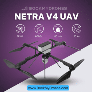
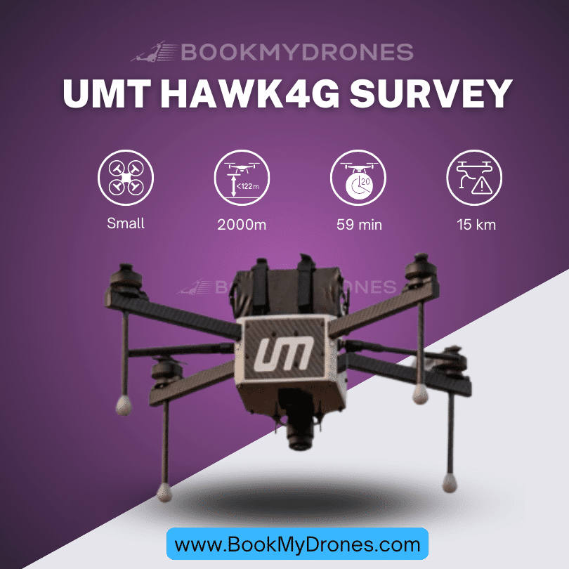
The Hawk4G® Survey is an incredible drone 🚁 designed specifically for surveying purposes. With its powerful capabilities and efficient performance, it revolutionizes the traditional surveying methods by saving both time and money. Let’s delve deeper into the specifications and features of this remarkable UAV.
Weighing just 3.2 kilograms ⚖️, the Hawk4G® Survey is a lightweight yet robust drone that guarantees smooth and stable flights. Its aerodynamic design coupled with advanced technology enables it to cover vast areas in a single flight 🌍. This eliminates the need for manual surveys and significantly reduces the overall time and expenses associated with traditional surveying methods.
Equipped with a long-lasting battery, the drone can stay airborne for an impressive duration of 40 to 59 minutes ⌛. This ensures extended flight time, allowing for more efficient data collection and surveying operations. The Hawk4G® Survey also boasts a remarkable 1.7 GSD accuracy, ensuring precise and reliable survey data.
When it comes to speed, this drone doesn’t disappoint. With a maximum speed of 54 kilometers per hour 🏎️, it can swiftly navigate through the survey area, capturing valuable data along the way. The Hawk4G® Survey can cover an astounding 315 acres per flight 🌾, making it an ideal choice for large-scale surveys and complex land mapping projects.
One of the standout features of this drone is its single pilot operation 🕊️. With the help of our reliable ground control station (GCS), the UMT Launch Pad, the entire surveying process becomes fast and simple. A single pilot can effortlessly control the drone, capture high-quality survey data, and ensure smooth flights without the need for additional operators.
For aerial surveys at higher altitudes, the Hawk4G® Survey offers a service ceiling of up to 2000 meters above mean sea level 🏔️. This capability allows for comprehensive and accurate mapping of challenging terrains and hard-to-reach areas. Despite harsh weather conditions, the drone’s remarkable maximum wind resistance of 54 kilometers per hour 💨 ensures stable flights and dependable data acquisition.
To further enhance its capabilities, the Hawk4G® Survey offers a variety of optional payloads. The FLIR Thermal Camera allows for thermal imaging, making it possible to detect heat signatures and identify potential problem areas. Additionally, the 24/32/40-megapixel day camera captures high-resolution images to create detailed maps and accurately measure distances. Moreover, a LiDAR sensor, set to be introduced in the future, promises even more advanced surveying capabilities.
In conclusion, the Hawk4G® Survey is a game-changer in the world of surveying. From its impressive flight endurance and speed to its high-accuracy data collection, this drone provides a comprehensive end-to-end solution for all surveying needs. With the Hawk4G® Survey and its incredible features, surveying professionals can elevate their operations and obtain accurate survey data efficiently. 🌟