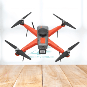
🚁 The RYNO UAV is an impressive micro category survey-grade drone that excels in accuracy and performance. It is specifically designed for mapping, land surveying, mining area planning, construction, and real estate purposes.
📐 With a ground sampling distance (GSD) of less than 5 cm, the RYNO UAV allows for incredibly detailed and precise mapping. Its absolute X & Y accuracy is outstanding, offering results within a margin of less than 10 cm. It can cover an area of 1 square kilometer when flying at an altitude of 120 meters above ground level (AGL).
💼 The RYNO UAV is equipped with an advanced mapping payload and a cutting-edge post processed kinematic (PPK) module. This combination ensures survey-grade performance, providing accurate data for a variety of applications.
📸 The drone boasts a high-quality payload, including a 24 MP camera with APS-C sensor. This enables the capture of clear and detailed images for mapping purposes. The drone’s storage capacity is 64 GB, which can be expanded if needed.
🚀 The RYNO UAV has an impressive typical cruise speed of 10 m/s, allowing it to cover larger areas efficiently. Its maximum operating altitude above ground level (AGL) is 400 meters, in accordance with your country’s guidelines. The maximum launch altitude above mean sea level (AMSL) is an impressive 3000 meters.
☔️ The RYNO UAV is IP53 rated, making it resistant to dust and drizzle. This ensures its performance even in challenging weather conditions.
⏱️ With an endurance of up to 40 minutes, the RYNO UAV can accomplish a significant amount of surveying tasks within a single flight. It provides ample time for data collection and efficient mapping operations.
Overall, the RYNO UAV is a powerful and reliable drone that offers exceptional accuracy and performance for survey-grade applications. Its advanced features and robust design make it an ideal choice for professionals in various industries. 🌐🛰️🏗️📈


