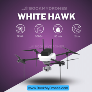
The Q6 UAV, affectionately known as our “surveying and mapping champion,” is a small category drone that excels in large-scale mapping projects. 🌍🚁 With its quadcopter design and high area coverage, it outperforms our other UAVs in terms of speed and efficiency.
One of the most impressive features of the Q6 UAV is its operational range, which spans up to 10 kilometers. 💪 This extensive range allows the drone to survey vast territories without any loss in signal or control. Whether it’s mapping remote areas or monitoring expansive construction sites, the Q6 UAV will always ensure that you’re covered.
In addition to its impressive range, the Q6 also boasts an enviable flight time of over 60 minutes. ⏰🛩️ This means that the drone can stay airborne for an extended period, drastically reducing the need for multiple take-offs and landings during a mapping mission. This not only saves time but also reduces operational costs.
To support its extensive capabilities, the Q6 UAV has a maximum take-off weight of up to 6 kilograms. 🏋️ This allows for a considerable payload capacity, making it ideal for carrying essential surveying and mapping tools. When it comes to payload options, the Q6 offers a unique combination of a mapping payload with a PPK (Post-Processed Kinematic) module. By integrating ideaForge’s survey-grade payload with a PPK antenna, the Q6 ensures survey-grade performance. 📷🌐
When it comes to capturing precise and detailed images, the Q6 UAV is equipped with an impressive camera. Sporting a resolution of over 20 megapixels and a sizable 64 GB storage (expandable), this drone offers stunning imagery and ample storage capacity for your mapping needs. The APS-C sensor further enhances the image quality, delivering professional-grade results. 📸✨
In terms of live transmission, the Q6 UAV boasts an impressive range of up to 5 kilometers Line of Sight (LOS). This means that the drone can transmit live footage directly to the operator without any interference, as long as there are no obstructions in the way. 📡📺
With a typical cruise speed of 10 m/s, the Q6 can swiftly cover vast areas during a mapping project. Its battery-powered electric propulsion ensures a smooth and efficient flight. The drone is capable of flying at altitudes of up to 500 meters Above Ground Level (AGL), giving it a comprehensive view and allowing for thorough mapping. It can also be launched at altitudes of up to 3000 meters Above Mean Sea Level (AMSL). ☁️🚀
The Q6 is designed to withstand challenging environmental conditions, as it holds an IP53 rating for dust and drizzle resistance. While it may not be fully waterproof, this self-certified rating ensures the drone’s durability and capability to withstand light dust and drizzle encountered during outdoor missions. 💦🌧️
Finally, the endurance of the Q6 UAV is truly remarkable. With an endurance of up to 60 minutes at a take-off altitude of up to 1000 meters AMSL, this drone ensures that mapping missions can be completed efficiently and effectively. 🕒✅
Overall, the Q6 UAV is a powerful and versatile drone perfectly suited for surveying and mapping projects. Its impressive range, flight time, payload capacity, and robust features make it a reliable choice for professionals in need of accurate and efficient data collection. 🌐✈️


