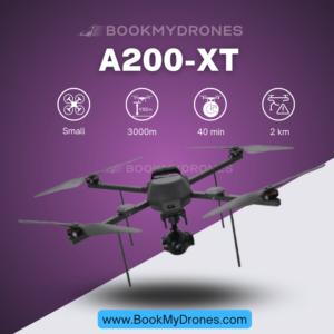
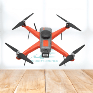
In addition to its certification by the DGCA, India’s first micro-category drone, the A200, offers a range of impressive features. One notable aspect is its high-resolution imaging capabilities, which make it suitable for various mapping applications. Equipped with a 24.1 MP imaging camera and an APS-C sensor, the A200 is capable of capturing sharp and detailed images.
To ensure the utmost accuracy, the A200 is equipped with a L1/L2 multi-band GNSS receiver with full PPK capability. This allows the drone to capture precise geotags of each image taken during flight, resulting in orthophotos with high accuracy. This feature makes the A200 an excellent choice for surveying and mapping applications where precise measurements are crucial.
Despite its advanced capabilities, the A200 remains compact and lightweight. This makes it easily operable by a single person, enhancing its efficiency and practicality. Moreover, the drone comes packed in a rugged IP67 certified hard case, along with all the necessary accessories for a full day of flight operations. This ensures portability and security, allowing users to transport the drone safely and conveniently.
Asteria, the company behind the A200, has also developed a user-friendly Mission Control Software (MCS) specifically for this drone. The MCS simplifies the piloting process, allowing users to plan their flight path with just a few clicks. This intuitive software streamlines the mapping process and enhances the overall user experience.
In summary, India’s A200 micro-category drone offers a diverse range of features that make it a valuable tool for various applications. With its certification from the DGCA, high-resolution imaging capabilities, survey-grade accuracy, compact design, and user-friendly software, the A200 sets a high standard in the drone industry.


